
Remote sensing, a cutting-edge technology, is transforming the agricultural industry by providing valuable insights and improving crop management practices. This innovative approach involves the use of satellite imagery, drones, and other advanced sensors to collect data about soil conditions, plant health, and water availability. By harnessing the power of remote sensing in agriculture, farmers can make data-driven decisions, optimize resource allocation, and ultimately boost crop yield. In this article, we will delve into the fascinating world of remote sensing and explore its numerous benefits for the agricultural sector.
Understanding Remote Sensing in Agriculture
Remote sensing in agriculture refers to the process of gathering data about crops and agricultural lands using various technologies such as satellite imagery, drones, and ground-based sensors. These tools capture information about soil composition, crop health, temperature, moisture levels, and other vital parameters that are crucial for effective farm management.
The Role of Satellite Imagery
Satellite imagery plays a pivotal role in remote sensing by providing a bird’s-eye view of agricultural lands. Satellites equipped with high-resolution cameras capture images of vast areas, allowing farmers and researchers to monitor crop growth, detect changes in vegetation, and identify potential issues such as pest infestations or nutrient deficiencies.
Harnessing the Power of Drones
Drones have revolutionized the way remote sensing is conducted in agriculture. These unmanned aerial vehicles (UAVs) can fly over fields and collect data at a much finer scale compared to satellites. Equipped with various sensors, drones can capture detailed images, measure plant height, assess crop health, and even analyze soil moisture content. The data collected from drones enables farmers to make precise decisions regarding irrigation, fertilizer application, and pest control.
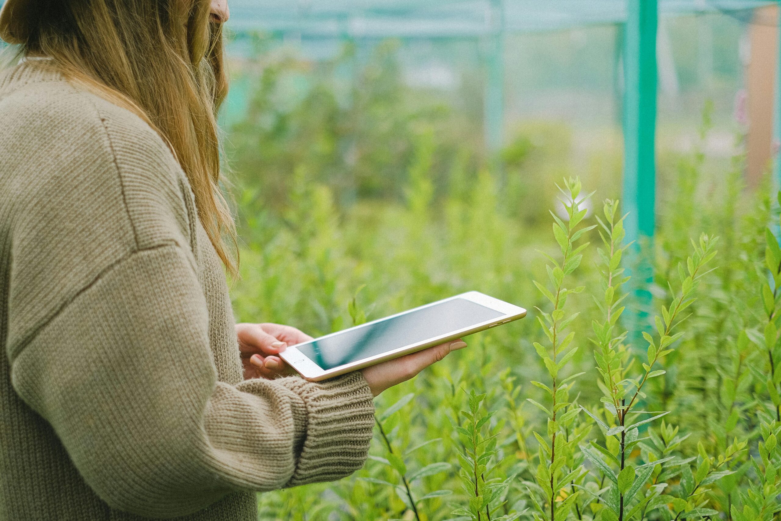
Ground-Based Sensors for Real-Time Monitoring
In addition to satellite imagery and drones, ground-based sensors are used for real-time monitoring of agricultural parameters. These sensors can be installed in the soil to measure moisture levels, temperature, and nutrient content. They can also be attached to plants to track growth rates, monitor photosynthesis, and detect stress factors. The data collected by these sensors provides farmers with accurate and up-to-date information, allowing them to take immediate action and optimize crop management strategies.
By utilizing a combination of satellite imagery, drones, and ground-based sensors, remote sensing in agriculture offers tremendous potential for improving productivity, reducing resource wastage, and ensuring sustainable farming practices. In the following sections, we will explore the various applications and benefits of remote sensing in greater detail.
Applications of Remote Sensing in Agriculture
Remote sensing technology has a wide range of applications in agriculture, revolutionizing traditional farming methods and offering valuable insights for better decision-making. Let’s explore some of the key applications:
Precision Agriculture
One of the primary applications of remote sensing in agriculture is precision farming. By analyzing satellite imagery and drone data, farmers can identify variations in soil fertility, moisture levels, and crop health within their fields. This information enables them to create customized management plans, optimizing the use of water, fertilizers, and pesticides. Precision agriculture helps reduce costs, minimize environmental impact, and maximize crop yields.
Crop Monitoring and Disease Detection
Remote sensing allows farmers to monitor their crops throughout the growing season. By analyzing satellite images and drone data, they can track the growth rate, identify areas of poor vegetation, and detect early signs of diseases or pest infestations. This early detection enables prompt intervention, preventing the spread of diseases and minimizing yield losses. Additionally, remote sensing helps farmers assess the effectiveness of disease management strategies by monitoring the progression or containment of infections.
Water Management
Remote sensing plays a crucial role in efficient water management in agriculture. By analyzing satellite imagery and sensor data, farmers can accurately assess soil moisture levels, identify areas prone to water stress, and determine optimal irrigation schedules. This information helps farmers minimize water wastage, reduce irrigation costs, and prevent over or under watering, leading to improved water use efficiency and sustainable agricultural practices.
Crop Yield Estimation
With remote sensing technology, farmers can estimate crop yields even before the harvest. By analyzing satellite imagery and drone data, they can assess plant health, monitor growth patterns, and estimate crop biomass. This information helps farmers predict potential yields, make informed marketing decisions, and optimize post-harvest logistics and storage.
The applications of remote sensing in agriculture are vast and continuously expanding as technology advances. By leveraging the power of remote sensing, farmers can enhance productivity, optimize resource utilization, and contribute to a more sustainable and resilient agricultural sector.
Benefits of Remote Sensing in Agriculture
Remote sensing offers numerous benefits to the agricultural industry, empowering farmers with valuable information and insights. Let’s explore some of the key advantages:
Improved Decision-Making
By utilizing remote sensing data, farmers can make informed decisions based on accurate and up-to-date information about their crops. Whether it’s optimizing irrigation schedules, adjusting fertilizer application rates, or implementing pest control measures, remote sensing enables farmers to take precise actions that result in improved productivity and reduced costs.
Enhanced Resource Allocation
Remote sensing technology helps farmers allocate resources more efficiently. By understanding the variations in soil conditions, moisture levels, and crop health across their fields, farmers can tailor their resource allocation strategies. This ensures that water, fertilizers, and other inputs are utilized precisely where and when they are needed, minimizing waste and maximizing their impact.
Early Detection of Issues
Remote sensing allows for early detection of potential issues, such as crop diseases, nutrient deficiencies, or pest infestations. By identifying these problems at an early stage, farmers can implement targeted interventions, preventing the spread of diseases and minimizing yield losses. Timely actions based on remote sensing data can save crops and protect farmers’ investments.
Increased Efficiency and Productivity
With the help of remote sensing, farmers can streamline their operations and increase overall efficiency. By utilizing precision agriculture techniques, they can reduce manual labor, optimize machinery usage, and minimize unnecessary treatments. This not only saves time and resources but also increases productivity, allowing farmers to achieve higher yields with fewer inputs.
Sustainable Farming Practices
Remote sensing promotes sustainable farming practices by enabling farmers to monitor and manage their crops in a more environmentally friendly manner. By using water and fertilizers more efficiently and applying pest control measures only when necessary, farmers can reduce their impact on the environment, conserve resources, and contribute to a more sustainable agricultural system.
Remote sensing in agriculture is revolutionizing the way farmers approach crop management. With its numerous benefits, this technology is empowering farmers to make data-driven decisions, optimize resource utilization, and adopt sustainable practices, ultimately leading to a more productive and resilient agricultural sector.
Challenges and Future of Remote Sensing in Agriculture
While remote sensing has revolutionized agriculture, it also comes with its own set of challenges. Let’s explore some of the key challenges and the future prospects of remote sensing in agriculture:
Data Interpretation and Analysis
Interpreting and analyzing the vast amounts of data collected through remote sensing can be a complex task. It requires specialized knowledge and expertise to extract meaningful insights from the data. As remote sensing technology advances, there is a growing need for advanced data analytics tools and algorithms that can process and interpret the data accurately and efficiently.
Cost and Accessibility
Remote sensing technologies, such as satellite imagery and drones, can be costly to acquire and maintain. The initial investment and ongoing expenses may pose a challenge, particularly for small-scale farmers with limited resources. Moreover, accessibility to remote sensing technologies, especially in remote or underdeveloped regions, can be a hindrance. Efforts are being made to make remote sensing more affordable and accessible, which will democratize its benefits across the agricultural sector.
Integration with Existing Systems
Integrating remote sensing technology with existing farm management systems and practices can be a challenge. Farmers may need to acquire new skills and adapt their workflows to effectively utilize the data provided by remote sensing. Seamless integration with other technologies, such as farm management software or machinery, is crucial to leverage the full potential of remote sensing in agriculture.
Continued Technological Advancements
The future of remote sensing in agriculture looks promising with ongoing technological advancements. There is a constant need for higher resolution imagery, more accurate sensors, and faster data processing capabilities. As technology evolves, remote sensing will become even more precise, efficient, and cost-effective, enabling farmers to have a more comprehensive understanding of their fields and make better-informed decisions.
Emerging Applications
The potential applications of remote sensing in agriculture are continuously expanding. Emerging technologies, such as hyperspectral imaging and machine learning, are being explored to further enhance the capabilities of remote sensing. These advancements may enable the detection of specific crop diseases or nutrient deficiencies, precise yield predictions, and even automated decision-making systems based on remote sensing data.
Despite the challenges, remote sensing holds immense potential for the future of agriculture. With further advancements and increased accessibility, it is expected to play a pivotal role in sustainable farming practices, resource optimization, and food security.
The Bottom Line: Remote Sensing Revolutionizing Agriculture
Remote sensing technology has emerged as a game-changer in the field of agriculture, offering unprecedented insights and transforming traditional farming practices. By harnessing the power of satellite imagery, drones, and ground-based sensors, farmers can access valuable data about their crops, soil conditions, and water availability. This data-driven approach enables farmers to make informed decisions, optimize resource allocation, and maximize crop yield.
From Precision Agriculture to Sustainable Farming
Precision agriculture, made possible through remote sensing, allows farmers to tailor their management practices according to the specific needs of their crops. By analyzing satellite imagery and drone data, farmers can identify variations in soil fertility, moisture levels, and crop health within their fields. This enables them to apply resources precisely where and when they are needed, resulting in reduced costs and increased productivity.
Moreover, remote sensing plays a crucial role in promoting sustainable farming practices. By monitoring soil moisture levels, optimizing irrigation schedules, and implementing targeted pest control measures, farmers can minimize water wastage, reduce the use of chemicals, and contribute to a more environmentally friendly agricultural system.
Enhancing Food Security and Resilience
With a growing global population and the challenges posed by climate change, ensuring food security and building resilience in agriculture are of paramount importance. Remote sensing technology provides valuable tools for monitoring and managing agricultural lands on a large scale. By accurately estimating crop yields, detecting diseases early, and optimizing resource utilization, remote sensing helps farmers mitigate risks, make informed decisions, and contribute to global food security.
The Future of Remote Sensing in Agriculture
The future of remote sensing in agriculture looks promising. As technology continues to advance, remote sensing will become more accessible, affordable, and user-friendly. The integration of remote sensing with other emerging technologies, such as artificial intelligence and machine learning, holds immense potential for further enhancing the capabilities of agricultural practices.
As farmers continue to adopt remote sensing technologies and benefit from the insights they provide, the agricultural sector as a whole will witness increased efficiency, reduced environmental impact, and improved productivity. Remote sensing is set to revolutionize the way we approach agriculture, paving the way for a more sustainable and resilient future.
In conclusion, remote sensing in agriculture is transforming the industry by providing valuable data and insights that empower farmers to make informed decisions, optimize resource utilization, and contribute to sustainable farming practices. By embracing this technology, we can revolutionize our approach to agriculture and build a more resilient and productive future.
Remote sensing technology is revolutionizing the agriculture industry, offering farmers valuable insights and transforming traditional farming practices. By utilizing satellite imagery, drones, and ground-based sensors, farmers can access accurate and up-to-date data about their crops, soil conditions, and water availability. This data-driven approach enables precise decision-making, optimal resource allocation, and increased crop yield.
Precision agriculture techniques, made possible through remote sensing, allow farmers to customize their management practices based on specific field conditions. By analyzing satellite imagery and drone data, farmers can identify variations in soil fertility, moisture levels, and crop health, enabling them to apply resources precisely where and when they are needed. This results in reduced costs, improved efficiency, and increased productivity.
Remote sensing also plays a crucial role in promoting sustainable farming practices. By monitoring soil moisture levels, optimizing irrigation schedules, and implementing targeted pest control measures, farmers can minimize water wastage, reduce the use of chemicals, and contribute to a more environmentally friendly agricultural system.
Furthermore, remote sensing technology contributes to food security and resilience in agriculture. By accurately estimating crop yields, detecting diseases early, and optimizing resource utilization, farmers can mitigate risks, make informed decisions, and contribute to global food security.
As technology continues to advance, remote sensing in agriculture will become more accessible, affordable, and integrated with other emerging technologies. The future holds immense potential for further enhancing the capabilities of remote sensing in agriculture, allowing for even more precise and efficient farming practices.
In conclusion, remote sensing technology is reshaping the agricultural landscape by providing farmers with valuable data and insights. Through its applications in precision agriculture, sustainable farming practices, and enhancing food security, remote sensing revolutionizes the way we approach agriculture. By embracing this technology, we can build a more efficient, sustainable, and resilient agricultural sector for the future.